For the first time, Greek researchers are undertaking a detailed reconstruction of the ancient Aegean coastline, with a primary focus on the islands of Milos and Kimolos.
This innovative geoarchaeological project in the Cyclades is meticulously charting the dramatic changes in the coastal landscape over the past 6,000 years.
The interdisciplinary team is employing a comprehensive approach, combining geomorphological indicators, bathymetric data, and observations of ancient dated structures found on the seabed.
Their goal is to precisely pinpoint ancient port facilities, analyze historical harbor morphologies, and trace forgotten sea routes. Crucially, the research also seeks to quantify the profound shifts in the Aegean’s coastline, attributing these changes to both geotectonic activity and the relentless impact of climate change.
The Aegean coastline sank by 5 meters in the last 6,000 years
“Over the last 6,000 years, the total relative sea level rise across the Northern and Central Cyclades has reached five meters, systematically recorded on islands like Kea, Kythnos, Andros, Paros, Antiparos, Naxos, Delos, and Mykonos through submerged landforms and ancient structures,” explains Dr. Eleni Kolaiti, a geoarchaeologist, scientific associate of the National Research Foundation, and partner of the Scientific Society for the Study of Ancient Coastlines (AKTES), who directs the research.
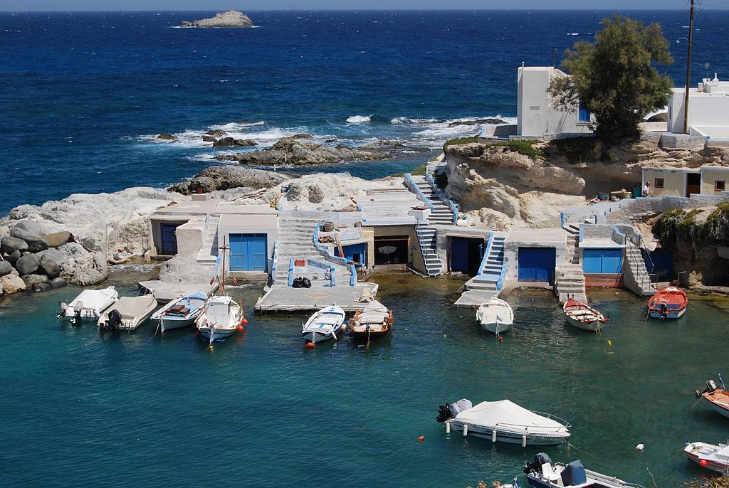
Milos and Kimolos coastline by 10 meters
“However, this phenomenon intensifies dramatically, with almost double the rate of sea level rise in areas prone to geotectonic disturbances, particularly the westernmost islands of the Southern Cycladic volcanic arc, specifically Milos and Kimolos.”
Dr. Kolaiti highlighted in an interview with Ta Nea newspaper the recent seismic activity in the central Aegean volcanic arc as a clear indicator of the intense tectonic deformation in this region. This area, strategically vital, was home to a thriving maritime civilization centered in prehistoric Thera and, further west, Fylakopi on Milos’s northern coast.
Astonishing discoveries beneath the Aegean
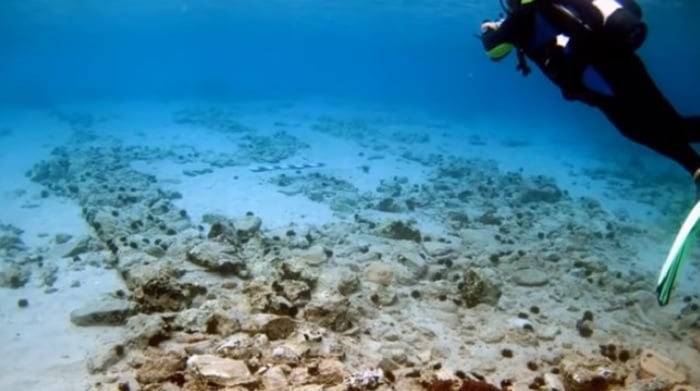
The ongoing research has already yielded significant findings, providing tangible evidence of ancient coastal life now submerged. For instance:
The classic port facilities of the ancient city of Milos, located on the Klima coast, are now found submerged at depths of 6 to 11 meters. Today, the sea periodically floods the “Syrmata,” the distinctive storage warehouses for fishing boats from the previous century, marking a visible legacy of the rising waters.
Roman port facilities and building remains in the settlement of Pollonia are located up to 5.50 meters below the current sea level.
Perhaps most dramatically, the southwestern coast of Kimolos, particularly the bay of Ellinika with the islet of Agios Andreas, holds the ruins of the ancient city of Kimolos on its seabed.
Roads, monumental buildings, an extensive cemetery with numerous sarcophagi and funerary monuments, wells, and pens lie up to 5 meters below the present sea level. An extensive stone beach, submerged 5.50 meters deep and 300 meters from the current coast, clearly marks the ancient shoreline.
Submerged ancient quarries and building ruins have also been identified on Kimolos’s Kalamitsi and Klima coasts, at depths of up to 3.50 and 6.50 meters respectively.
A particularly important discovery is the submerged early Christian catacomb carved into the rocky northwestern coast of Kimolos at Pelekiti. The majority of this sacred site is now inundated by the sea, with its floor at a depth of 3 meters.
Further evidence of past sea levels comes from three generations of petrified beaches observed on the coasts of both Milos and Kimolos at depths of 5.50, 1.40, and 0.80 meters, radiometrically dated from the 9th to the 19th century AD.
Other findings about the ancient Aegean coastline
The specific examples cited by Dr. Eleni Kolaiti are consistent with findings from many other coastal and island archaeological sites across Greece.
The Pavlopetri site in Laconia, Peloponnese, is perhaps the most famous example of a submerged ancient city (dating back 5,000 years), whose submergence is attributed to a combination of sea level rise and seismic activity. This demonstrates the wider phenomenon of ancient coastal settlements now lying underwater.
Many archaeological studies on ancient harbors throughout the Mediterranean (including Delos) document submerged breakwaters, quays, and other structures due to post-Roman sea-level changes.
Related: Sacred Island of Delos in Danger of Flooding, Greek Scientists Warn