

An international team of researchers says Egypt’s Karnak Temple was founded on a rare island of high ground that once emerged from surrounding Nile waters, shaping both the temple’s location and its religious meaning.
The conclusions come from the most detailed geoarchaeological investigation ever carried out at the Karnak Temple Complex, one of the largest and longest-used religious sites of the ancient world. The study was led by researchers from Uppsala University and published in the journal Antiquity.
A temple shaped by a living river
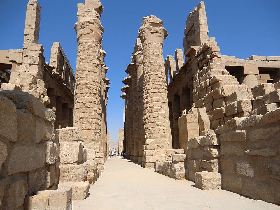
Karnak stands today in the modern city of Luxor, about 500 meters (0.3 miles) east of the Nile River. In ancient times, the area formed part of Thebes, the religious heart of Egypt. While the temple now sits on dry land, researchers say its surroundings looked very different thousands of years ago.
The study shows that Karnak was built within a dynamic river landscape. Seasonal floods, shifting channels, and wetlands dominated the area, forcing ancient builders to adapt to constant environmental change.
Rebuilding the ancient landscape beneath Karnak
To reconstruct that early environment, researchers drilled 61 sediment cores from inside and around the temple precinct. These samples preserved layers formed by flooding, river movement, and human activity. The team also analyzed tens of thousands of ceramic fragments to date occupation phases and track how people used the land.
Together, the evidence allowed researchers to map ancient waterways, floodplains, and stable surfaces hidden beneath the stone monuments visible today.
From floodplain to foundation
The findings show that before about 2520 BCE, the site was unsuitable for permanent settlement. Fast-moving floodwaters regularly swept across the area, leaving no stable base for construction.
The earliest signs of human activity appear during the Old Kingdom, between roughly 2591 and 2152 BCE. Pottery fragments dating from about 2305 to 1980 BCE support this timeline and point to gradual early use of the area.
New research reveals Egypt’s Karnak Temple was built on rare high ground that once rose from surrounding Nile waters, shaping both its location and religious meaning.#KarnakTemple #nile pic.twitter.com/ipgcLr2EPS
— Tom Marvolo Riddle (@tom_riddle2025) January 6, 2026
Researchers say Karnak became viable only after natural river processes reshaped the land. Nile channels carved paths on both the eastern and western sides of a natural terrace, creating a small island of higher ground within the floodplain.
That elevated patch, now in the east and southeast part of the complex, remained relatively dry while the surrounding land flooded each year.
Expansion driven by shifting channels and human engineering
As centuries passed, river channels continued to move, opening new areas for construction. Karnak expanded in stages, growing into a vast complex used continuously from the Middle Kingdom through the Roman period.
One of the study’s most unexpected findings concerns the eastern river channel. Earlier research focused mainly on the western side of the site. The new analysis shows the eastern channel was more clearly defined and may have been larger than previously thought. It also remained part of the landscape until the first century BCE.
Evidence suggests ancient Egyptians actively reshaped their environment. Researchers found signs that desert sand was dumped into a silting river channel to reclaim land more quickly, allowing the temple footprint to expand.
Creation myths reflected in stone and soil
The reconstructed landscape closely mirrors ancient Egyptian creation myths. Old Kingdom texts describe creation as a mound of land rising from surrounding waters. The island beneath Karnak is the only known example in the region that matches this description.
Dr. Ben Pennington, lead author of the study and a visiting fellow at the University of Southampton, said the setting may explain why Karnak was chosen as a sacred site. Later Middle Kingdom texts describe a “primeval mound” emerging from the “Waters of Chaos.”
Each year, as Nile floodwaters retreated, the elevated ground beneath Karnak would have appeared to rise, visually reinforcing these beliefs.
Lessons from the past for protecting heritage
The research builds on earlier work published in Nature Geoscience in 2024 that traced environmental change across the Nile Valley over 11,500 years. The Karnak study adds a detailed local view of how landscape, belief, and power came together at a single sacred site.
The project was conducted with the support of the Egypt Exploration Society and permission from Egypt’s Ministry of Tourism and Antiquities. Researchers say the findings also offer insight into how ancient strategies for managing water and land may inform modern efforts to protect heritage sites facing environmental change today.

