

Greece is implementing a significant transformation in its approach to wildfires with the launch of the National Forest Fire Risk Assessment Map—the first of its kind in decades—signaling a major shift in national Civil Protection strategy.
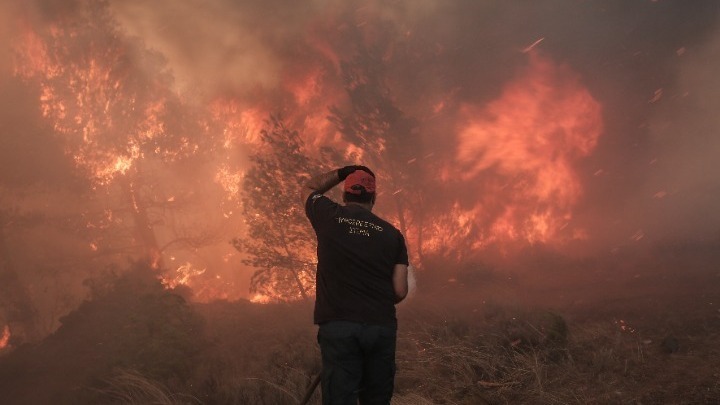
Greece’s need to reform its approach to forest fires stems from a disastrous confluence of environmental pressures and systemic vulnerabilities. In recent years, the country has been ravaged by increasingly intense and destructive wildfires. This trend is driven by severe environmental factors, including extreme heatwaves and strong winds.
The crisis has been worsened by long-standing issues concerning the nation’s forest management and fire prevention policies, highlighting systemic vulnerabilities that the climate crisis has ruthlessly exposed. The scale of the devastation necessitated a complete overhaul, with the new map being hailed by authorities as a structural breakthrough and one of the most significant reforms in the history of civil protection.
Greece to battle wildfire with predictive planning
The National Map provides a general, long-term overview of forest fire risk for different areas, fundamentally differentiating it from the short-term tools currently in use, and will be:
- Distinct from daily forecasts: This new map is not a replacement for the Daily Fire Risk Forecast Map (issued during the fire season). Instead, it serves as a long-term strategic tool, guiding long-term planning and prevention efforts by identifying chronic high-risk areas.
- Data-driven assessment: Approved by the Minister of Climate Crisis and Civil Protection, Yannis Kefalogiannis, the map utilizes robust data spanning the past twenty years. This includes regional climatic conditions, detailed vegetation types and structures, and the frequency of high-risk days from previous daily forecasts.
- Based on granular categorization: Unlike the previous method that classified areas by county, the new map uses municipalities as the unit of assessment, allowing for far more localized and targeted measures. As a result, municipalities are now ranked into three clear risk categories: low, medium, and high.
By providing a precise, granular, and data-backed risk assessment, the map aims to proactively address the underlying structural problems that have contributed to Greece’s wildfire disasters.
Related: Wildfires in Greece and Cyprus Intensified by Climate Change, New Study Finds

