
Researchers have used advanced digital tools to trace how ancient travelers moved across Greece, offering the clearest reconstruction to date of the Mycenaean road network. The new study shows how Bronze Age engineers shaped routes through difficult terrain and how modern modelling can help explain the purpose of these early roads.
The research, led by Christopher Nuttall and published in the Journal of Archaeological Science, compared hundreds of digital simulations against surviving road segments in the Peloponnese. The goal was to measure how closely computer-generated routes matched the paths carved into the landscape more than 3,000 years ago.
Digital tools shed new light on ancient Greek routes
The study relied on least-cost path analysis, a method that calculates the most efficient way to cross a landscape. It works by assigning a “cost” to movement—such as the energy needed to climb a slope—allowing researchers to identify routes that require the least physical effort. A path with fewer steep inclines, for example, has a lower cost and becomes the predicted route.
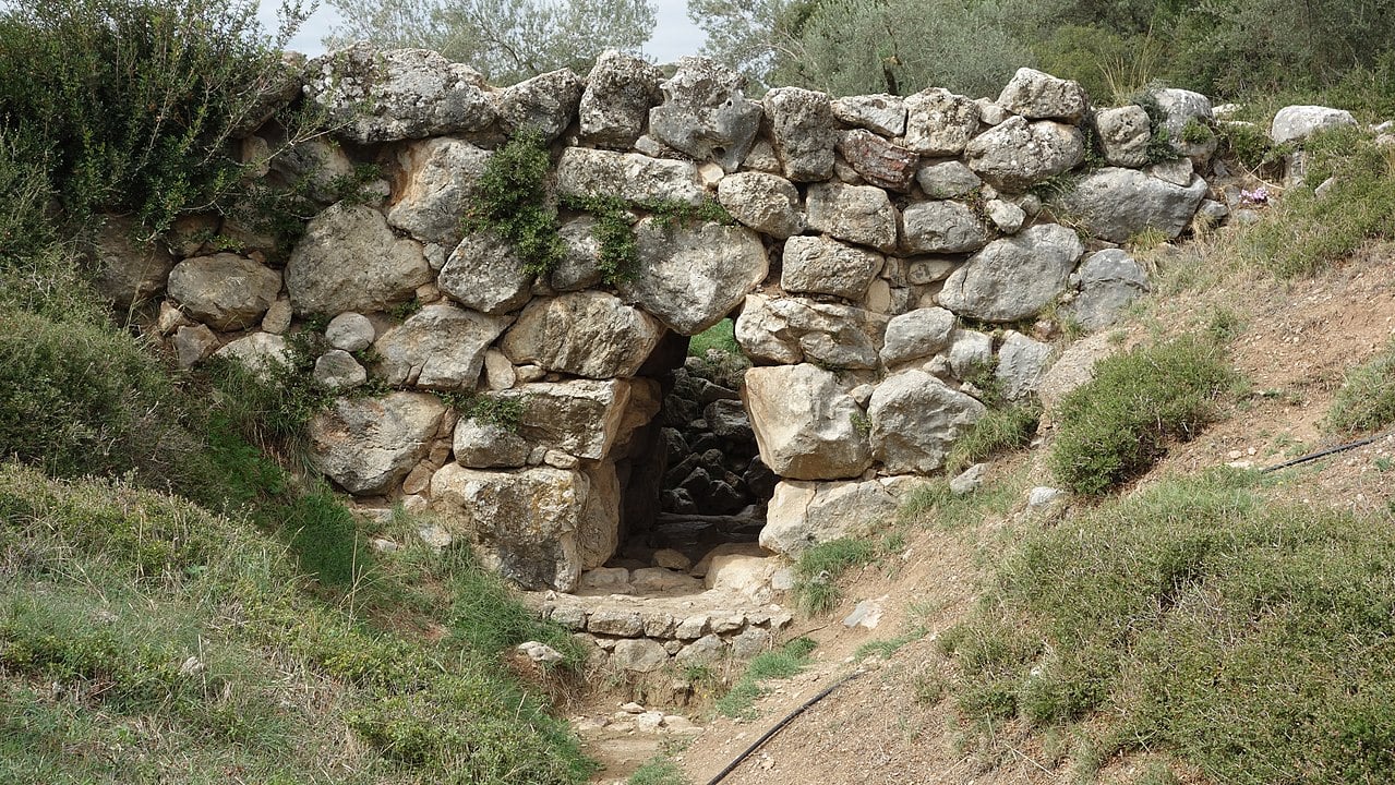
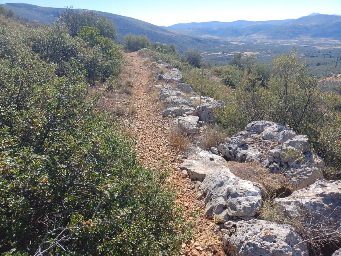
Nuttall’s team applied this technique to three real Mycenaean road segments: a route in Messenia, the well-preserved Tiryns–Epidauros road, and the M1 road leading northeast from Mycenae. These stretches still feature Bronze Age engineering, including stone paving, drainage systems, and bridges built with massive blocks. Their survival made them ideal reference points for testing the accuracy of the digital models.
Testing different models to match real road remains
Researchers tested five movement functions that simulate different types of travel, including walking, energy expenditure, and wheeled transport. They also varied parameters such as slope sensitivity, movement direction, and cognitive slope, which accounts for how humans perceive steep terrain.
Each road was modelled under hundreds of combinations using two digital elevation datasets—NASA’s SRTM and the European Copernicus DEM. These tests helped confirm which settings best reproduced the actual routes still visible on the ground.
Across most cases, the strongest match came from the function designed for wheeled vehicles. This model accounts for “critical slope,” the point at which carts or wagons struggle to climb, forcing routes to curve or zigzag. The study found that Mycenaean roads in Messenia and the Berbati Valley aligned most closely with the simulated paths designed for wheeled transport.
Researchers say this suggests Mycenaean engineers planned their routes with carts in mind, likely to move goods, agricultural products, or military equipment across regions.
One exception was the Tiryns–Epidauros road. Here, the walking-based functions created the closest match, which may indicate that the route originated as an older footpath later upgraded into a formal road. The finding also supports the idea that this road may have begun at the ancient port of Nauplio, not directly at Tiryns, linking harbors on the Argolic and Saronic gulfs.
Ancient roads reveal their purpose across the Peloponnese
The digital results support long-held theories about Mycenaean movement. The possible road in Messenia appears to have connected coastal zones on the Bay of Navarino and the Messinian Gulf, offering a land shortcut that avoided sailing around the southern coastline. In the Argolid, the Tiryns–Epidauros route likely served the same purpose, easing the movement of goods between two major maritime zones.
The M1 road remains more uncertain. The models did not clearly support a direct route to Corinth. Instead, they point toward other possible destinations, including the port of Kalamianos or the upland area around Ayios Vasileios, a site with potential ritual significance.
Uncertain endpoints show the limits of current modelling
The study shows how sensitive these simulations are to the underlying data. Slight differences in slope or elevation can shift the predicted path. Because of this, Nuttall argues that least-cost models must be calibrated carefully and checked against physical evidence whenever possible.
Study sets a new benchmark for reconstructing ancient roads
The findings reinforce the idea that Mycenaean roads were part of a coordinated transport system linking palaces, ports, and regional centers. These routes supported trade, communication, and political control across the Peloponnese.
Nuttall concludes that modern digital tools can reveal how these early roads were planned and used, but only when combined with rigorous testing and archaeological evidence. As higher-resolution terrain data becomes available, researchers expect even more accurate reconstructions of the routes that shaped Bronze Age Greece.

