
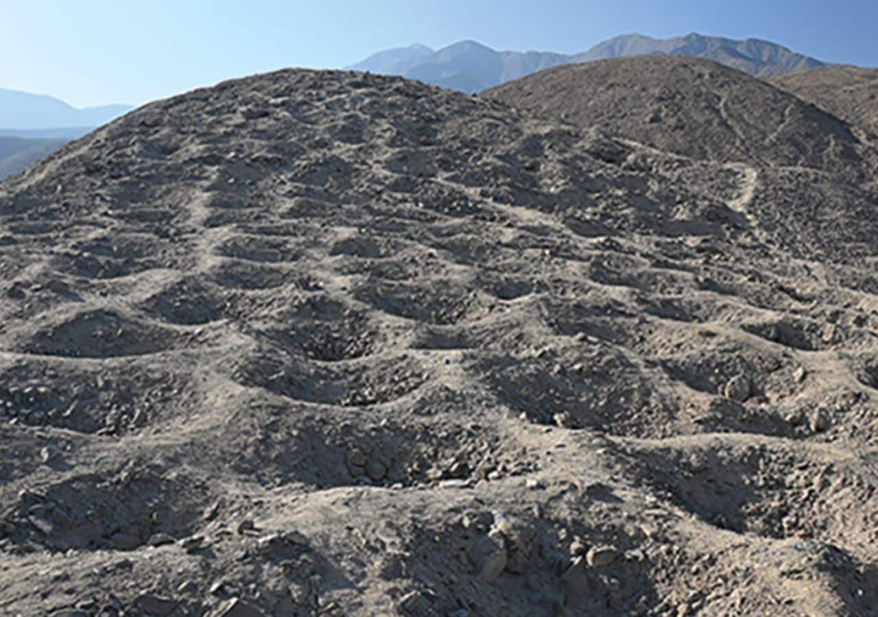
A mysterious stretch of more than 5,000 man-made holes carved into the foothills of the Andes in southern Peru may have once served as a bustling Indigenous marketplace, new research suggests. The site, known as Monte Sierpe or the “Band of Holes,” has puzzled archaeologists for decades due to its unusual design and unknown function.
Located in the Pisco Valley, Monte Sierpe covers 1.5 kilometers (0.93 miles) and features around 5,200 carefully aligned holes, each one to two meters (3.3 to 6.6 feet) wide and up to a meter (3.3 feet) deep.
Recent findings from the University of Sydney, published in Antiquity, indicate the site may have been used for organized trade and later adapted into a record-keeping system.
New findings suggest trade and social function
Researchers led by Dr. Jacob Bongers, a digital archaeologist at the University of Sydney and Visiting Research Fellow at the Australian Museum, analyzed both aerial imagery and microscopic plant remains from soil samples inside the holes. Their investigation revealed patterns suggesting intentional layout and possible cultural function.
The presence of ancient maize pollen and reed plants points to the storage or deposition of traded agricultural products, likely transported in baskets or bundled materials.
New research reveals that 5,000+ ancient holes carved into Peru’s Andes may have been part of a massive Indigenous marketplace and record-keeping system. A mystery closer to being solved. 🧺📜 #Archaeology #Peru #Andes #Inca #History #MonteSierpe #BandOfHoles pic.twitter.com/fM5NPicTbh
— Tom Marvolo Riddle (@tom_riddle2025) November 12, 2025
Bongers explained that the layout of the holes closely mirrors the structure of a known Inca khipu, a string-based accounting tool found in the same valley.
This similarity supports the idea that the holes may have later functioned as a large-scale recording system during the Inca period. He described Monte Sierpe as a form of social infrastructure that first enabled local trade and later evolved into a means of administrative control.
Monte Sierpe’s strategic role in Peru’s Andes as a marketplace of holes
The site’s strategic location further supports the marketplace theory. It lies between two former Inca administrative centers and near the intersection of key pre-Hispanic roads. It is also situated in a transitional ecological zone known as chaupiyunga, where communities from highland and coastal regions would likely have gathered to exchange goods.
Monte Sierpe first gained public attention in 1933 when aerial photographs were published in National Geographic. Since then, theories about its purpose have ranged from agricultural use and water collection to defense and storage. Until now, no explanation had been supported by both physical evidence and spatial analysis.
Bongers said the findings offer a new perspective on how ancient societies in the Andes shaped their environment to encourage economic and social interaction. While many questions remain, the study marks a step forward in understanding one of Peru’s most enigmatic archaeological features.
